Whether you ride your bike to Trader Joe’s to pick up groceries, pedal to Beacon’s for a sunrise surf before work, or cycle along the 101 through Encinitas on your coastal road ride, you’ll encounter various types of bike infrastructure in the city designed to provide you with a safe and comfortable riding experience. Encinitas streets have a variety of bike infrastructure across the city, designed to accommodate different roadway sizes, traffic levels, speed limits, and types of riders.
California’s bikeway classifications establish a framework for designing safe, efficient, and accessible infrastructure for people traveling by bike. Defined under the California Streets and Highways Code § 890.4, these classifications range from fully separated bike paths to shared-use roadways. They assist planners, engineers, and communities in creating a connected network of facilities that support cycling for both transportation and recreation.
Each classification offers a unique balance of safety, comfort, cost, and feasibility, depending on the street context and user needs. In this article, we’ll define each type of bikeway and provide insight into its purpose, advantages, limitations, and recommended use cases.
What's Covered Below:
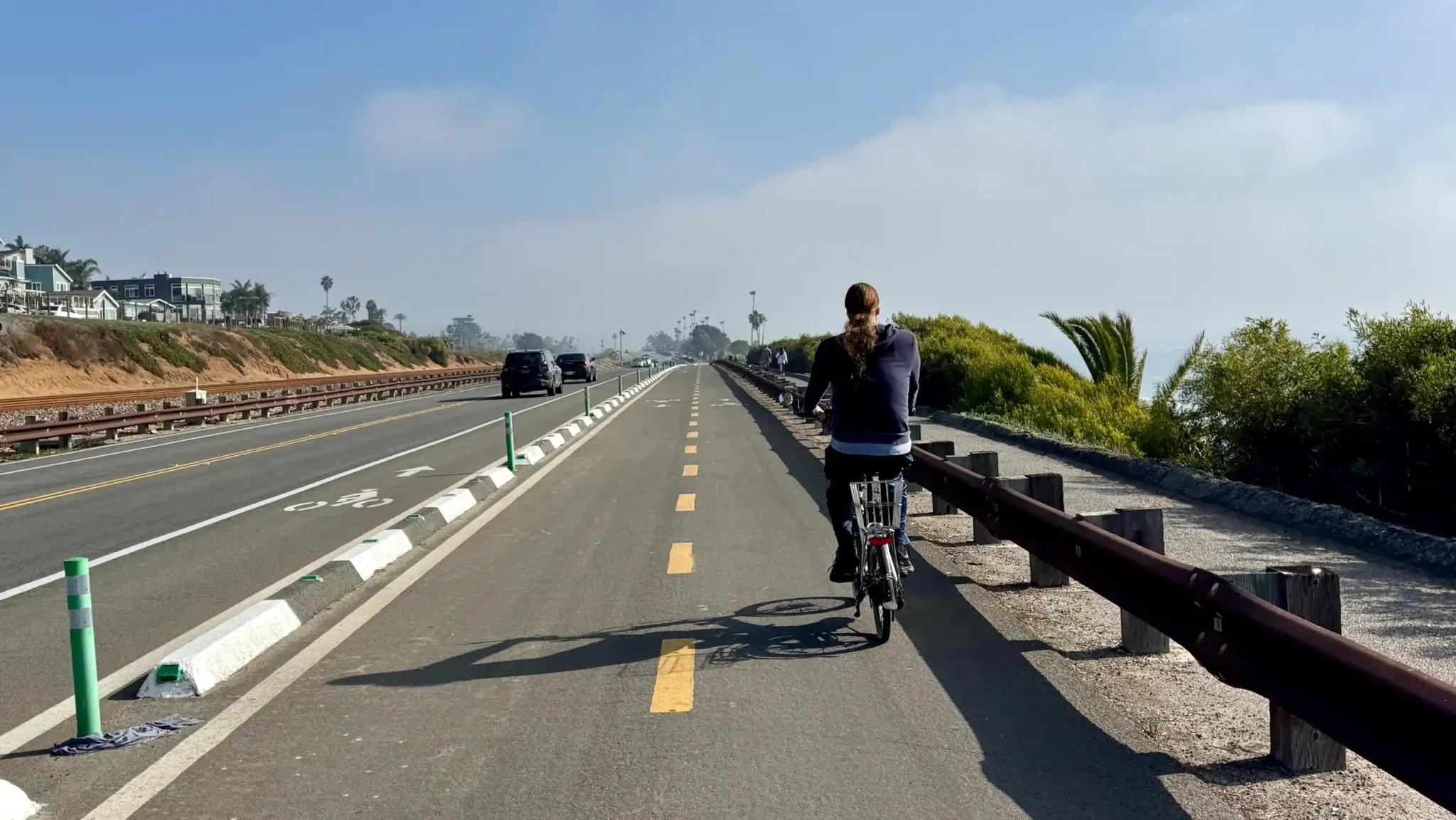
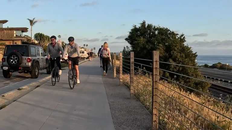
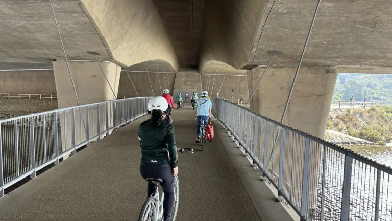
Bike Path / Shared Use Path (Class I)
Pros
- High safety: The absence of motor vehicle traffic enhances comfort for all users.
- Recreational appeal: Often scenic and relaxing, great for all ages.
- Encourages active travel: Especially for less experienced or hesitant cyclists, especially children.
Cons
- User conflicts: Shared use between cyclists, pedestrians and scooters can lead to congestion or collisions.
- Disconnected routes: May not serve practical commuting needs if isolated.
- Cost and space: Requires separate infrastructure and right-of-way.
Usage Notes
- Best for parks, greenways, waterfronts, and utility corridors
- Ideal for leisurely, recreational cycling and walking
- Should be wide enough to minimize pedestrian-bike conflicts (often a minimum of 10’ width)
- The San Elijo Coastal Rail Trail is less effective as a commuter route due to slow speed regulation and mixed use of cyclists, pedestrians, families and kids.
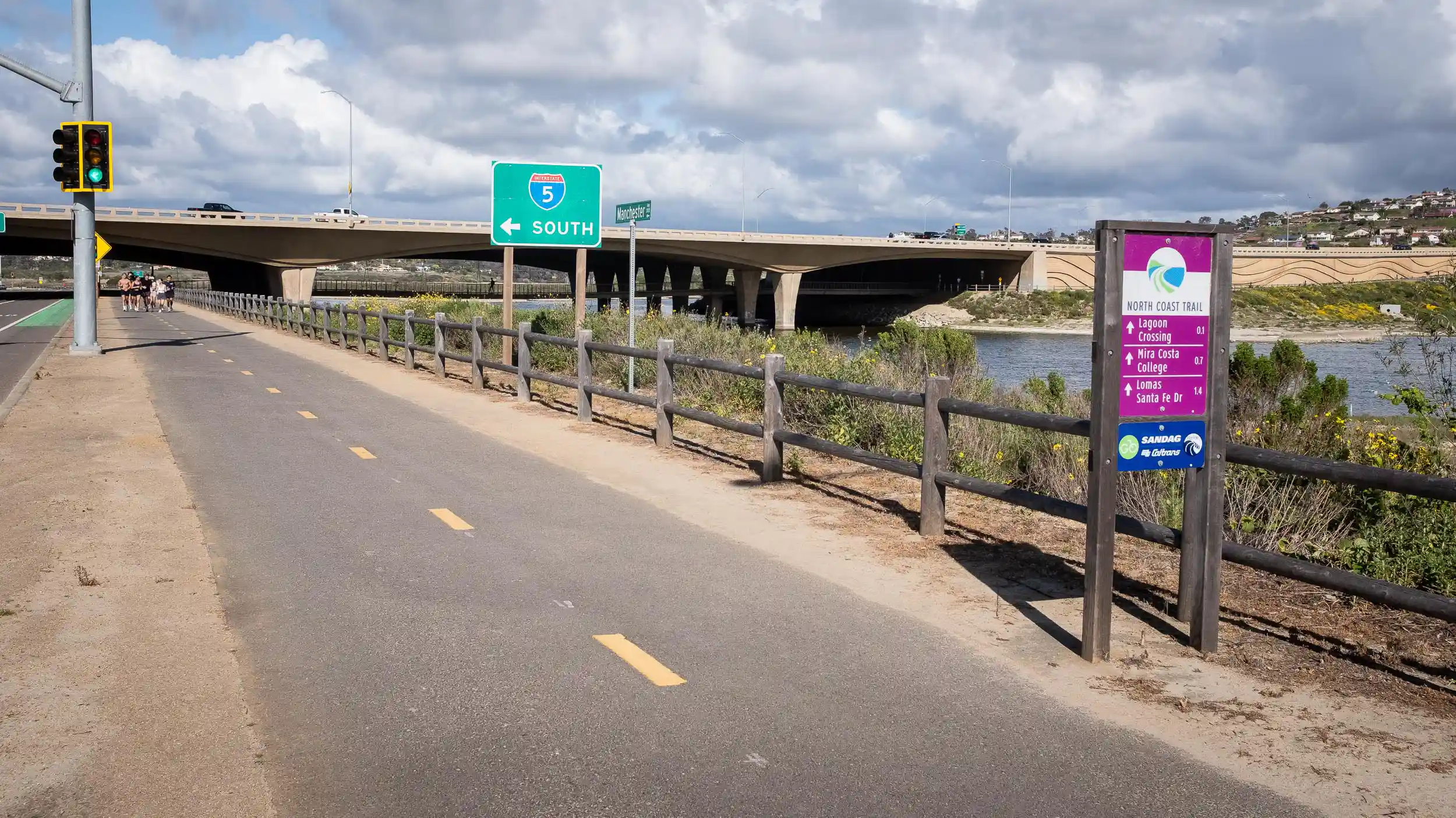
- The North Coast Bike Trail serves as a better commuter path for cyclists as it connects Encinitas with Solana Beach. It’s also popular for hikers accessing Annie’s Canyon.
Class I – Bike Path / Shared Use Path Examples around Encinitas
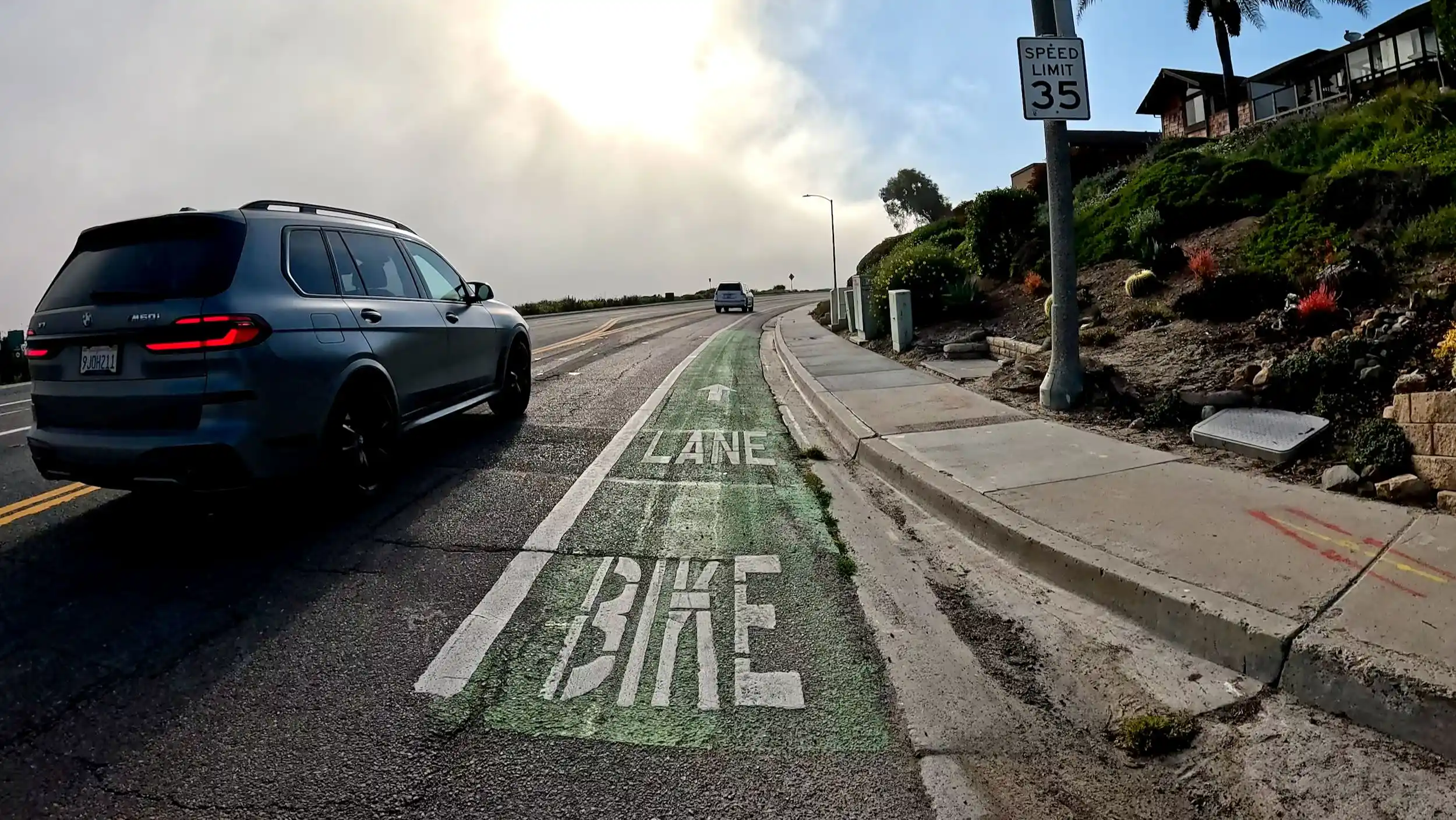
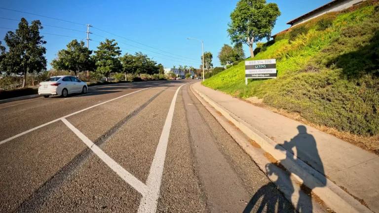
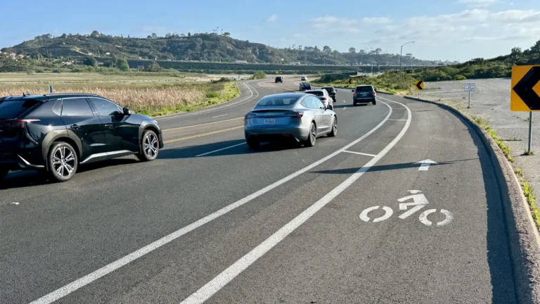
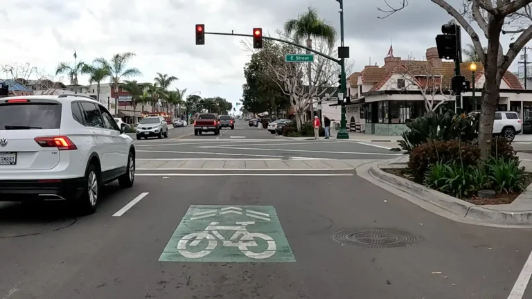
Bike Lane (Class II)
A Class II – Bike Lane is a portion of the roadway is designated by striping, signage, and pavement markings for the preferential or exclusive use of bicyclists. Motorists may cross the lane to turn or park, where permitted.
The intent of a Class II bike lane is to establish a dedicated space for bicyclists on existing roadways, enhance visibility, and encourage consistent bicycle travel on arterial and collector streets.
- Defined space: Visually indicates (with paint) designated areas for bicyclists.
- Cost-effective: Easily implemented with paint and signage.
- Supports direct routes: Commonly used on arterials and collector streets for more direct commuter access.
- Lower protection: Bikes are adjacent to moving traffic and parked cars. Paint does not provide any physical protection from motor vehicles.
- Door zone: Without any buffer, cyclists are positioned too close to parked cars that can unexpectantly open doors and seriously injure cyclists.
- Turning conflicts: Vehicles may cross lanes at driveways, intersections, and parking areas, creating additional conflict points with cyclists.
- Maintenance issues: Without any structural separations, bike lanes are subject to debris accumulation and fading markings.
- Best for arterials and collector streets with moderate speeds (≤35 mph)
- Should be combined with intersection treatments (e.g., green paint, conflict zone markings)
- Works well where full separation (Class IV) isn’t feasible due to space or cost
- Routine maintenance (sweeping, restriping) is essential
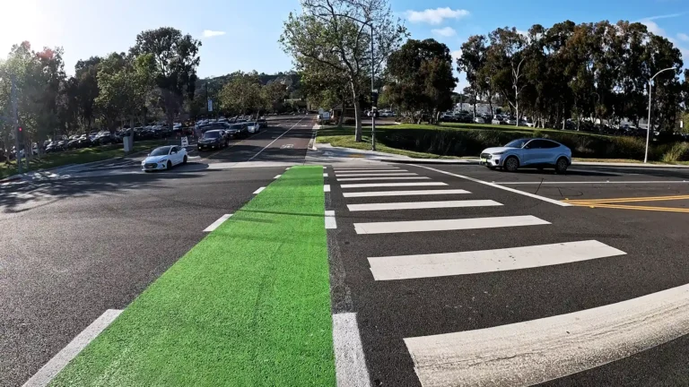
Class II – Bike Lane Examples around Encinitas
Fortunately, most Class II Bike Lanes in Encinitas have been improved to a Class II buffered status, but there are several streets that still have a Class II Bike Lane.
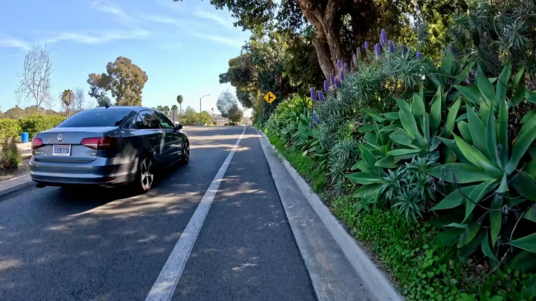
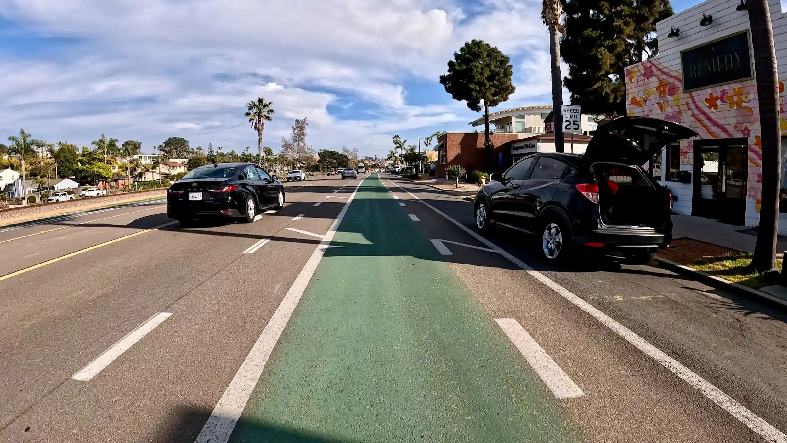
Buffered Bike Lane (Class II)
A Buffered Class II Bike Lane is a type of Class II bikeway enhanced with additional painted space—called a buffer—between the bike lane and the adjacent travel lane and/or parking lane. The buffer is created with diagonal or chevron striping and is not physically separated (e.g., no curb or bollards). The extra space designated by paint does not make it a Class IV separated bikeway, but it provides extra lateral space for cyclists within the roadway.
A Buffered Class II Bike Lane is designed to increase rider comfort and safety by creating additional space from moving vehicles or parked cars. Buffered bike lanes are particularly useful on streets with higher vehicle speeds or volumes than a typical Class II bike lane would feel comfortable for and where full separation (Class IV) is not feasible due to space or funding constraints.
Pros
- Increased perceived and actual safety: The buffer gives cyclists more space, especially from fast-moving vehicles or car doors.
- Low-cost upgrade: Often created by restriping existing roadways without major construction.
- Encourages more riders: More welcoming to less confident cyclists than standard bike lanes.
- Improves lane discipline: Visually discourages drivers from encroaching into the bike lane.
- Flexible design: Can be implemented with the existing pavement width.
Cons
- No physical protection: Still vulnerable to vehicle encroachment, unlike Class IV lanes.
- Can be misused: Some drivers may park or drive in the buffer space if not clearly marked or enforced.
- Maintenance required: Striping may fade and require regular repainting.
- Limited door zone mitigation: If placed next to parking, still requires careful design to avoid dooring risks.
- Not suitable for all streets: May not provide enough comfort on very high-speed or high-traffic roadways.
Usage Notes
- Best suited for arterial or collector roads with excess lane width or underutilized vehicle lanes.
- It can serve as a transitional treatment before a corridor is upgraded to a physically separated bikeway.
- Should include clear signage and markings to minimize confusion and misuse.
- Buffers between travel lanes and/or parked cars should ideally be at least 3 feet wide, especially adjacent to high-speed lanes or on-street parking areas.
Buffered Class II – Bike Lane Examples Around Encinitas
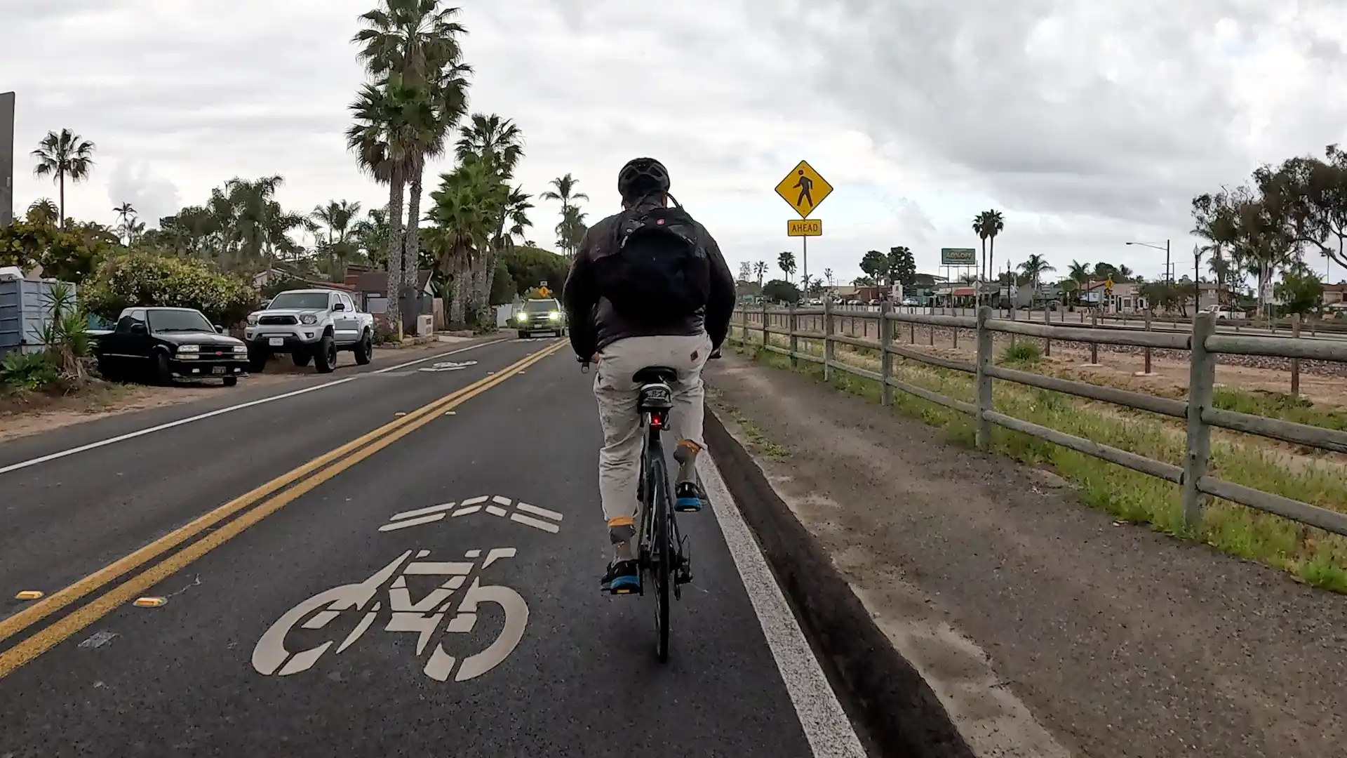
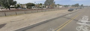
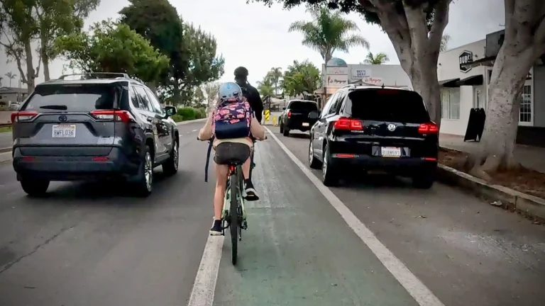
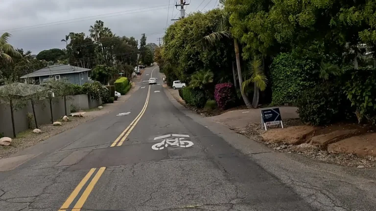
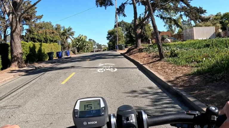
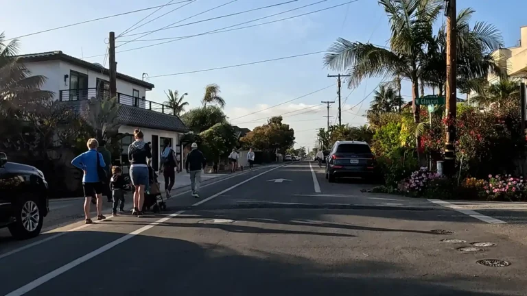
Bike Route (Class III)
A Class III – Bike Route is a shared-use roadway that is designated with signage or pavement markings (sharrows) to indicate preferred routes for bicycles, but does not include a dedicated bike lane.
They are designed to mark routes where bicyclists are expected to ride with traffic, often used to bridge gaps between higher-class facilities or on low-volume neighborhood streets.
Pros
- Low-cost implementation: Requires minimal infrastructure investment.
- Wayfinding aid: Helps cyclists navigate through street networks.
- Good for quiet streets: Works well where traffic speeds and volumes are low.
Cons
- No physical separation: Offers no protection from cars.
- Low comfort level: Not appealing to inexperienced or risk-averse riders.
- Drivers may disregard: Sharrows and signs often go unnoticed by motorists.
Usage Notes
- Best for neighborhood streets or low-traffic downtown corridors
- Functions as a connector between Class I, II, or IV segments
- Should be combined with wayfinding signage and traffic calming, where needed
- Avoid use on roads with speed limits above 30 mph unless additional safety measures are in place
Class III – Bike Routes Examples Around Encinitas
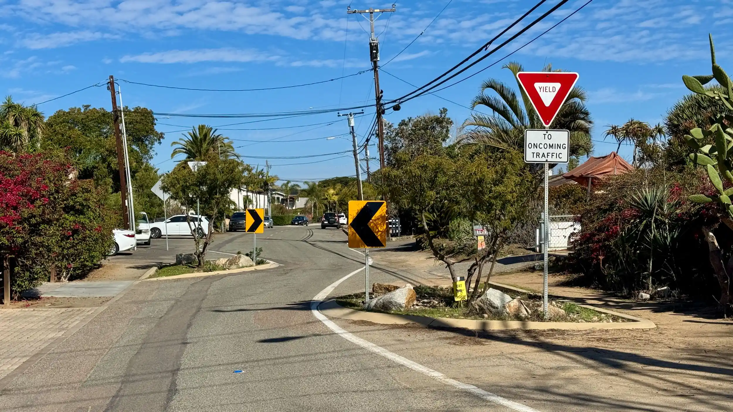
Neighborhood Bike Route or Bike Boulevard (Class IIIB)
A Class 3B bikeway—also known as a Neighborhood Bike Route, Neighborway, Greenway or Bike Boulevard—is a specialized form of Class III bikeway designed to prioritize bicycle travel on low-speed, low-traffic residential streets. While not officially defined in the California Streets and Highways Code, Class 3B is intended to differentiate these enhanced bike routes from standard Class III facilities.
A Class 3B bikeway is a shared roadway where bicycles and motor vehicles coexist, but with added features to enhance safety and comfort for cyclists. These features often include traffic calming measures, signage, and pavement markings to create a more bicycle-friendly environment.
The primary goal of a Class 3B bikeway is to create a safe and comfortable route for cyclists by:
- Reducing motor vehicle speeds and volumes through traffic calming.
- Providing clear signage and markings to indicate bicycle priority.
- Enhancing connectivity within the bicycle network, especially in residential areas, school zones and areas where dedicated bike lanes are not feasible.
Pros
- Enhanced Safety: Traffic calming measures reduce vehicle speeds, making the roadway safer for both cyclists and pedestrians.
- Reduced Motorist Speed: Enhances safety, reduces noise, and improves quality of life in neighborhoods.
- Cost-Effective: Utilizes existing roadways, minimizing the need for extensive construction.
- Community-Friendly: Encourages cycling in residential areas, promoting community engagement, healthier lifestyles, and reduced traffic congestion.
- Flexibility: Can be implemented in areas where space constraints prevent the installation of dedicated bike lanes.
Cons
- Limited Protection: Lacks physical separation between cyclists and motor vehicles, which may deter less confident riders.
- Potential for Motorist Non-Compliance: Drivers may ignore signage or traffic calming measures, reducing effectiveness.
- Maintenance Requirements: Traffic calming devices and pavement markings require regular upkeep to remain effective.
- Inconsistent Implementation: Variations in design and features across different jurisdictions can lead to confusion among users.
Usage Notes
- Ideal Locations: Residential streets with low traffic volumes and speeds, serving as connectors between major bikeways.
- Safe Routes for Schools: Bike boulevards improve safety for children riding to school.
- Design Considerations: Incorporate measures such as speed humps, curb extensions, and diverters to calm traffic effectively.
- Community Engagement: Involving local residents in the planning process can enhance acceptance and effectiveness.
- Monitoring and Evaluation: Regular assessments help ensure the bikeway meets safety and usage goals, allowing for adjustments as needed.
Class IIIB– Potential Neighborhood Bike Routes Examples Around Encinitas
While there are no official Class IIIB Bikeways in Encinitas, there are several residential streets that hold potential to be designated as Neighborhood Bike Routes due to their slow speeds, residential location, and proximity to schools, recreation and beach areas.
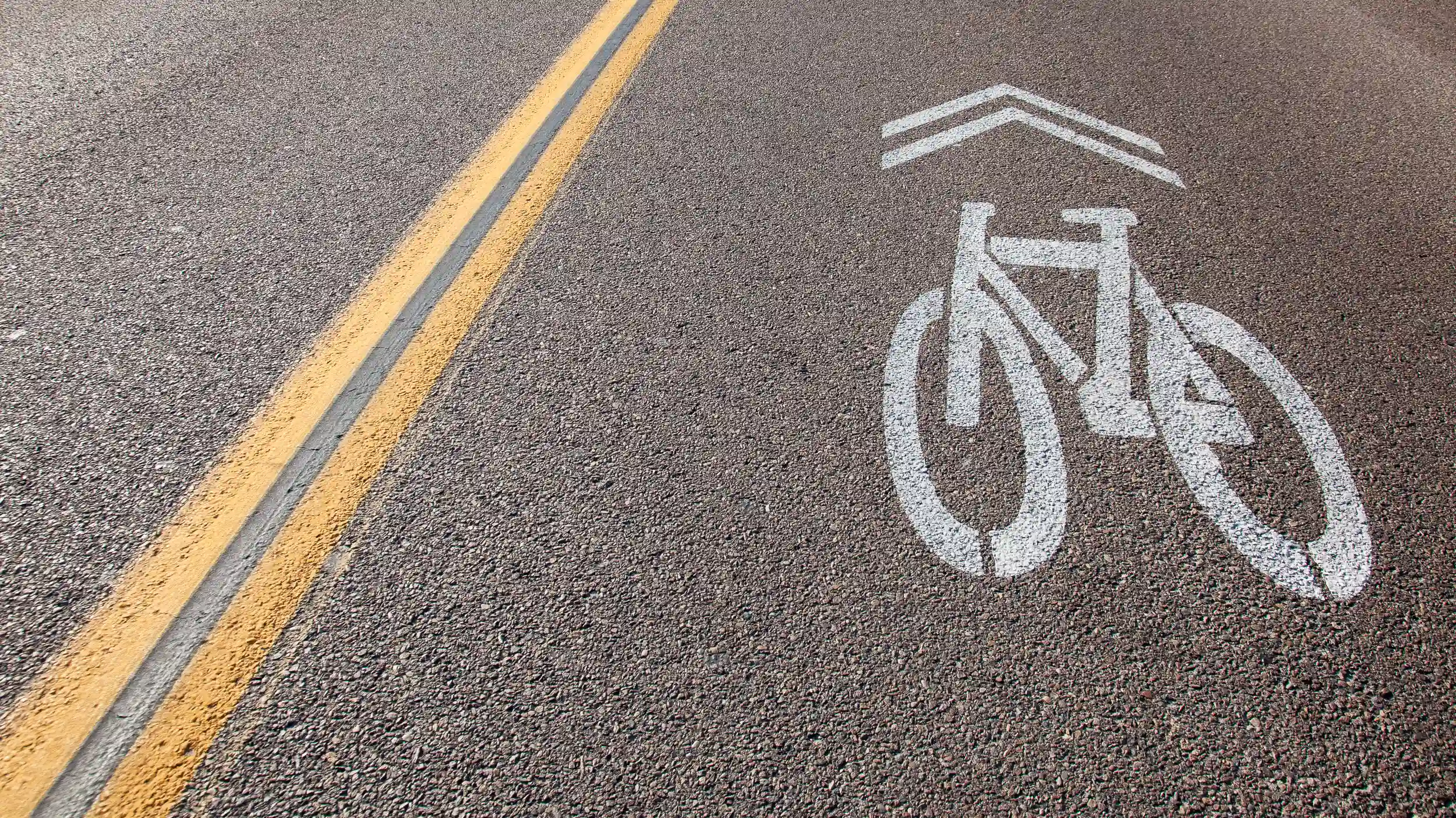
Sharrows on Class III Bike Routes
- Indicate a shared lane environment for bicycles and motor vehicles.
- Guide bicyclists to ride in the center of the lane, away from the “door zone” near parked cars.
- Remind motorists that bicyclists are legally allowed to use the full lane.
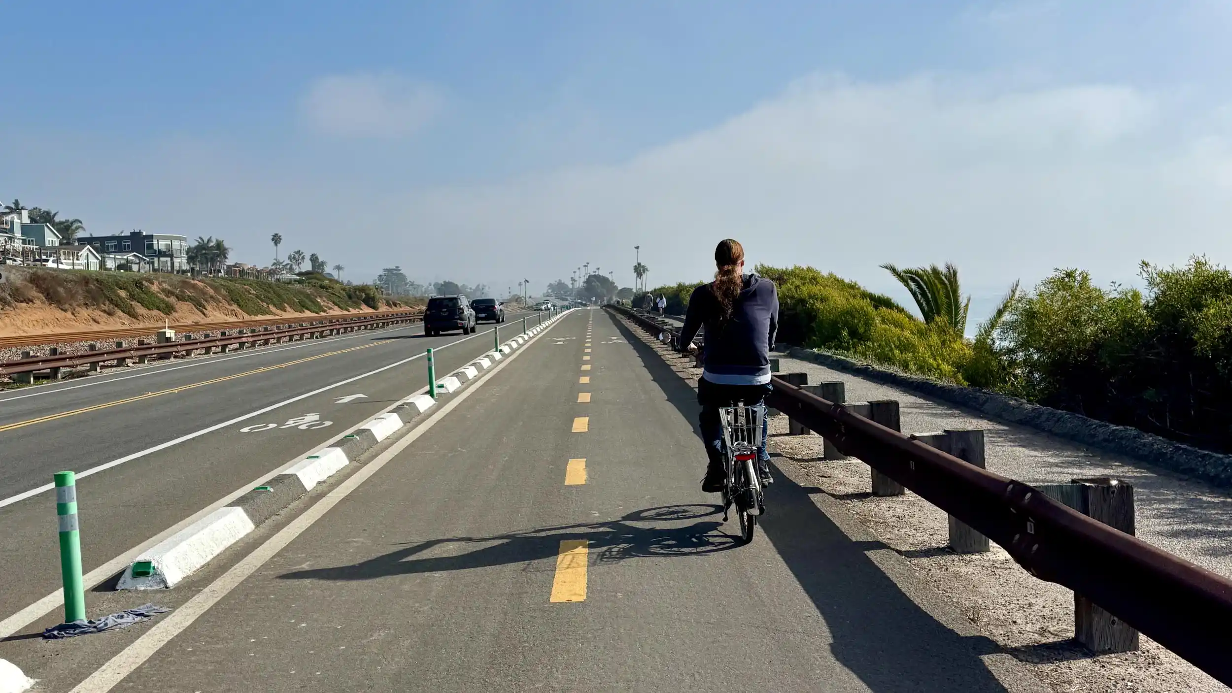
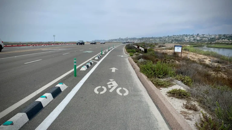
Separated Bikeway or Cycle Track (Class IV)
A Class IV – Separated Bikeway / Cycle Track is a bikeway for exclusive bicycle use, physically separated from vehicle traffic by barriers such as bollards, curbs, planters, or parked cars. Can be one-way or two-way.
Cycle Tracks are intended to maximize safety and comfort for cyclists by providing protected infrastructure on or adjacent to busy roadways, thereby encouraging broader public use of bicycles as a mode of transportation.
- High protection: Physical barriers significantly reduce the risk of crashes.
- Comfortable for all ages: Encourages more people to ride, including children and seniors.
- Urban mobility: Excellent for dense city environments with high demand for bike travel.
- Design complexity: Intersections, driveways, and bus stops require careful planning.
- Maintenance challenges: Debris and drainage need regular attention.
- Higher installation cost: Requires more materials and construction than other types of bikeways.
- Requires education: Upon initial installation, new infrastructure can be confusing for riders.
- Ideal for busy urban corridors with high traffic volumes and speeds
- Works well where bike volumes are high or desired to be
- Should include intersection design treatments to prevent turning conflicts
- Maintenance and visibility at driveways and crosswalks must be considered
Class IV – Separated Bikeway / Cycle Track Examples around Encinitas